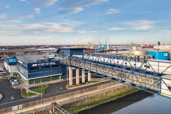
This was quite an adventure! We drove first to Hull, where we got the ferry to Rotterdam:-
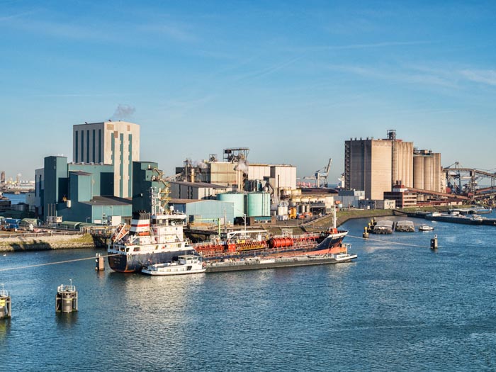
Overnight on the ferry, to a lovely sunny morning in Rotterdam, where we sailed in through the port and of course snapped a few photos of all the industry there:-
Then, we had to drive to the north of Denmark. This took two days. Should have been six hours driving each day, but due to an autobahn accident in Germany (not us) the first day took 9 hours. I was panicking in case the same thing happened on the second day, and we missed the ship, but luckily the roads were very quiet and we easily made it.
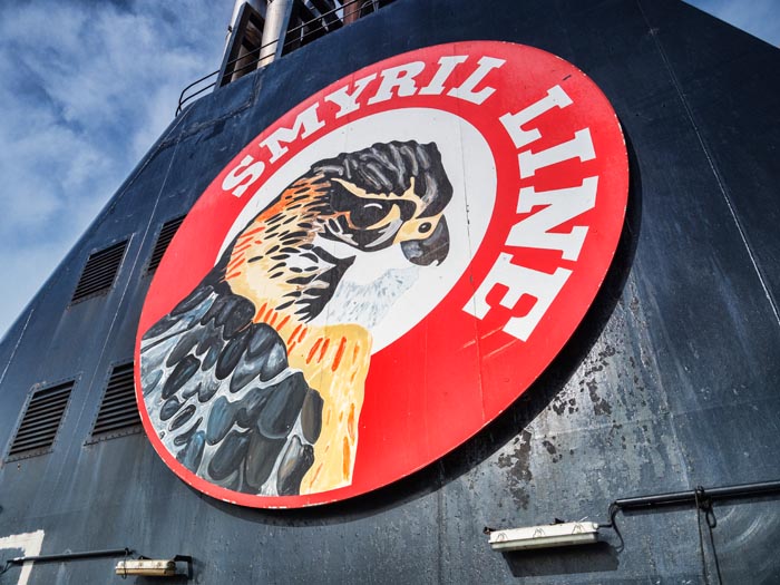
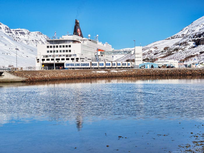
Then, in Denmark, we got the Smyril Line ferry to Iceland. The ship is a cross between a cargo ship, a ferry and a cruise liner. Sometimes it smelled a bit fishy!
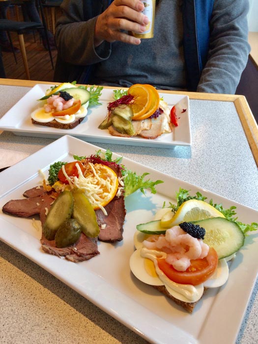
I had my birthday on the ship, and this is what I had. Plus a cake!
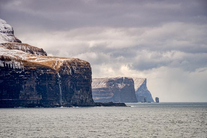
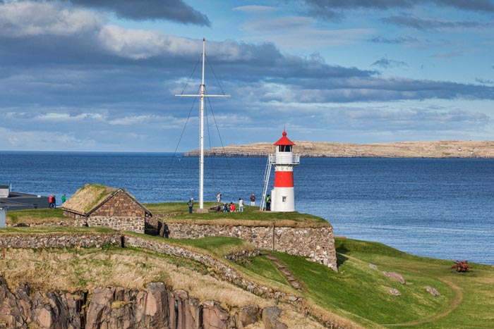
It’s a Faroe Islands ship, and we called in there on the way. It was really cold and miserable, far colder than Iceland. We got off the ship and had a good look round the town of Torshavn, and took lots of photos, but they are horrible. Just managed this one:-
The population of the Faroes is only just over 50,000, but you can still get your eyebrows tattooed:-
You can never get to the end of your bucket list, because everywhere you go, you find somewhere else you want to go. The ship spends about an hour sailing out between the islands, which look as if they’ll be lovely in good weather:-
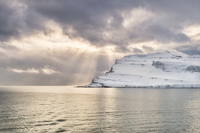
We were three nights on the ship, and this was our first view of Iceland. It was very exciting!
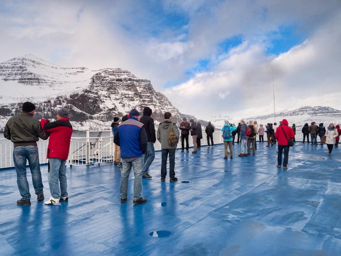
Of course everyone was up on deck, most people standing in front of some hot air vents!
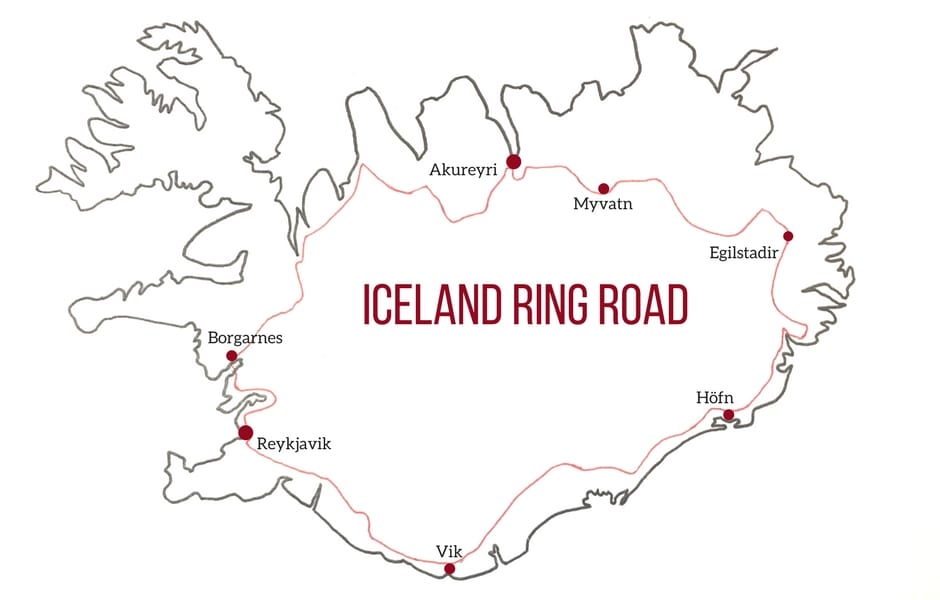
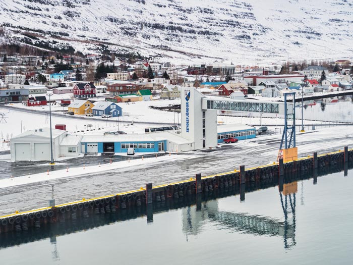
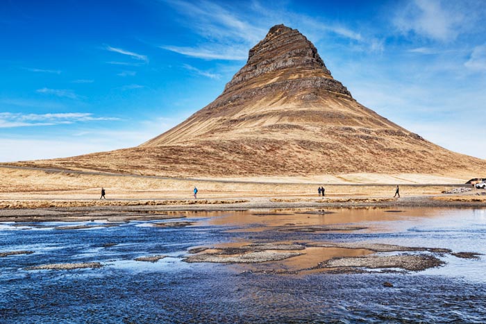
We sailed into Seydisfjordur, which on the map is to the right of Egilstadir:-
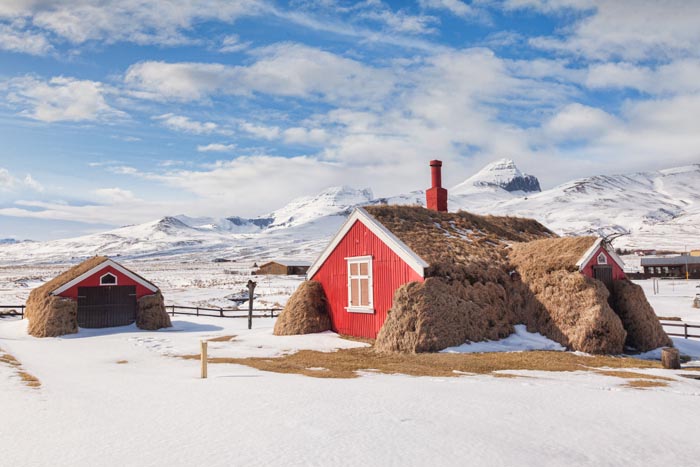
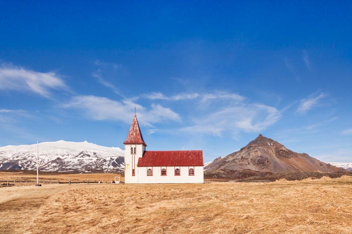
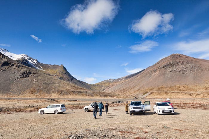
And headed for our first cottage, which was on a farm. We had an itinerary for the 15 days, telling us where to go, so followed that, and had our first Icelandic supermarket shop in Egilstadir. It is expensive, but if you are cautious, you needn’t spend that much. We took 3kg of food each with us, the most you are allowed, plus wine, and spent only £200 on supermarket food after that. There were a couple of ouch!!! moments when we ate out or had coffee, but we minimised them! This little village was on our first day’s itinerary:-
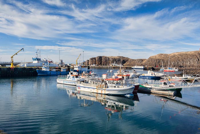
Next day was sunny, so we went back to Seydisfjordur, to see what it looks like in sun:-
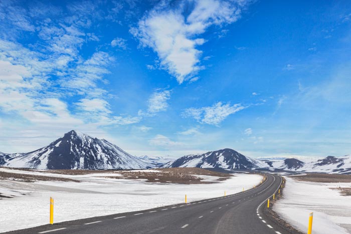
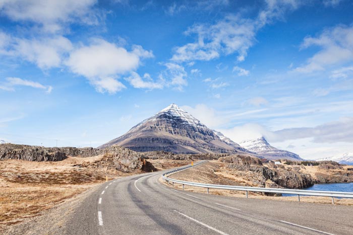
After just two nights in our first cottage (first of five) it was time to move on. We drove over a high mountain pass, through snow covered mountains. The scenery was stunning, I’m sorry this photo does not do it justice. Normally, when we take photos, we are isolating the best bits from their surroundings, but that’s not the case in Iceland. You are completely surrounded, and all a photo can do is give you just a little slice:-
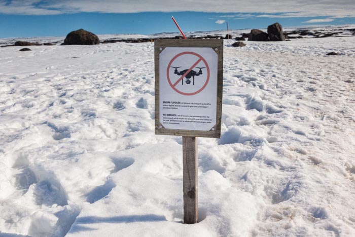
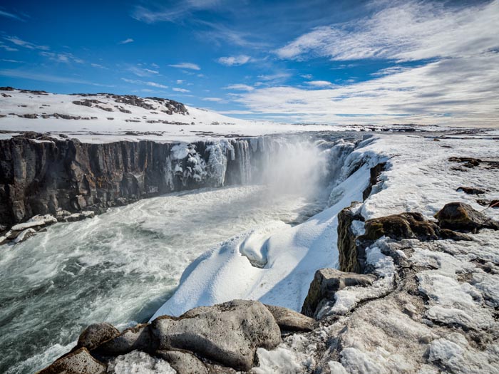
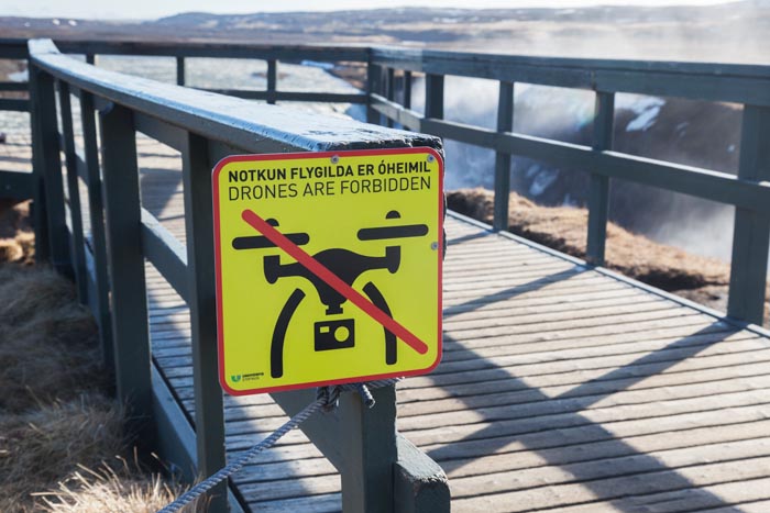
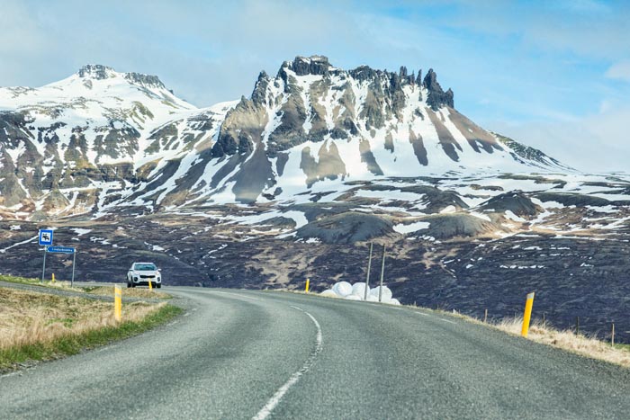
We called in at Dettifoss, Iceland’s biggest waterfall, but not that photogenic from where we were standing. There was lots of snow in the east of Iceland, which apparently gets the worst of the weather. It made us realise that we probably don’t want to go in winter, as it’s just too difficult to get to the attractions. The No Drones signs are everywhere, in all the major attractions (not that we have a drone):-
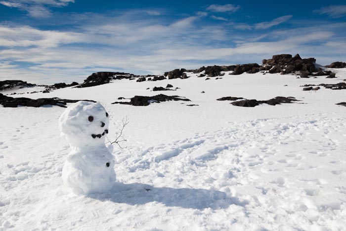
We saw this lovely snowman, but vandals are everywhere. When we came back, all his features were thrown on the floor.
Anyway, Selfoss, wasn’t too bad a waterfall, just a short trudge through the snow:-
[vimeo 264487319 w=640 h=564]
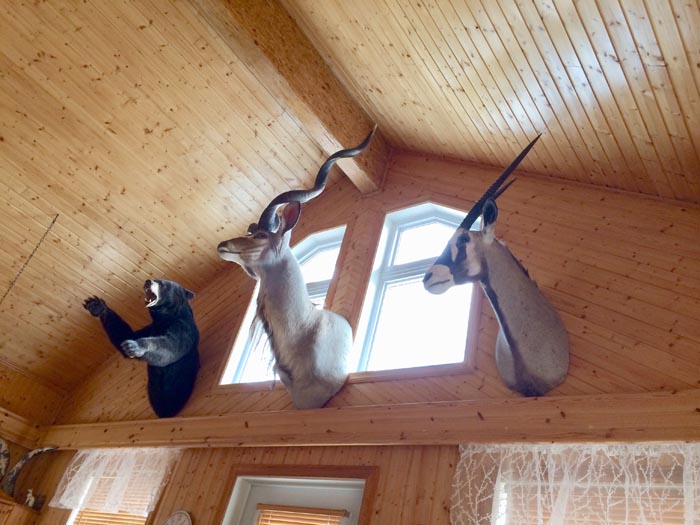
Our second cottage was the nicest of the ones we had, but I’ve not stayed anywhere before with dead animals on the wall:-
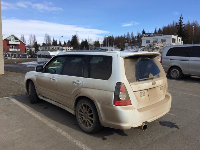
Our car after one day’s driving:-
Apparently, Iceland was discovered in the 9th century by accident, by a Faroese called Naddodd, who drifted off course and found himself in Iceland. He sailed up the coast and over wintered at Husavik on the North coast:-
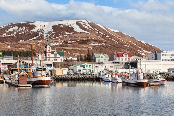
It’s the Icelandic whale watching capital now. At that time, Iceland was covered in trees, then 250 years of volcanic eruptions and 400 years of mini ice age left the island as it is now. They have a huge problem with soil erosion, due to strong winds.
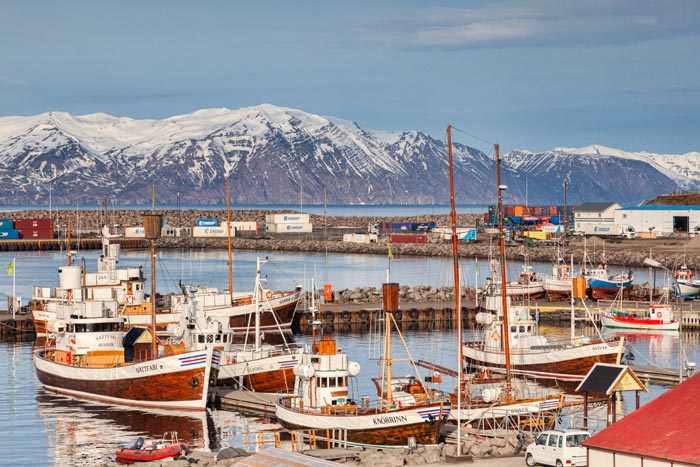
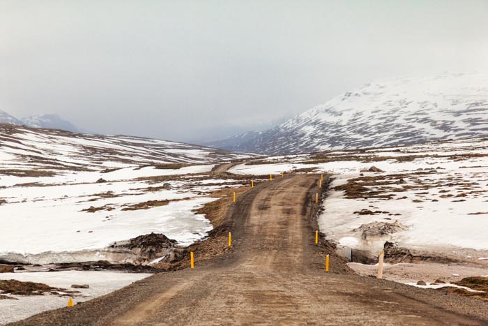
Not very nice weather up in the north. During our whole stay we had three days when we didn’t bother going out, but at our age we were quite glad of a rest. You can easily get that many bad days in a two week holiday in the UK, and in New Zealand!
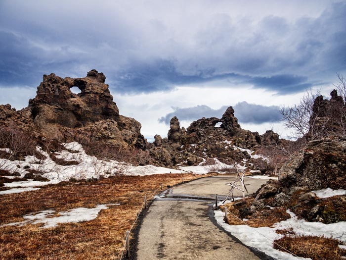
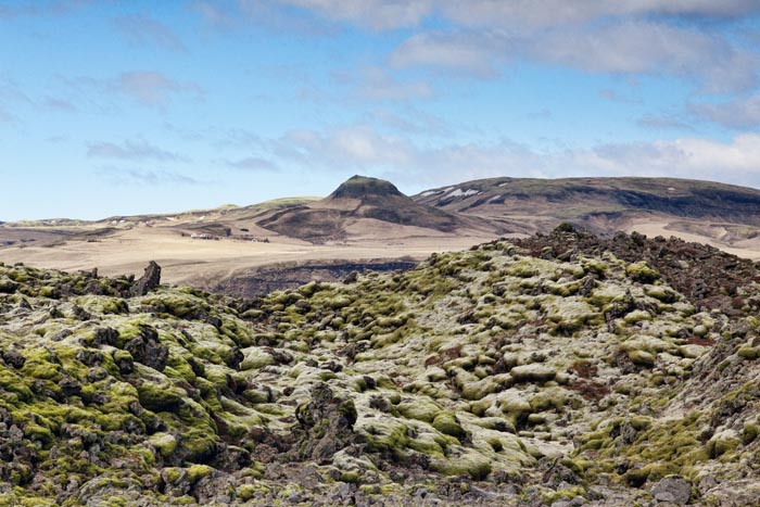
Iceland has a lot of lava. It is half the size of New Zealand, and has 130 volcanoes. Imagine the Tongariro crossing, spread over most of the North Island!
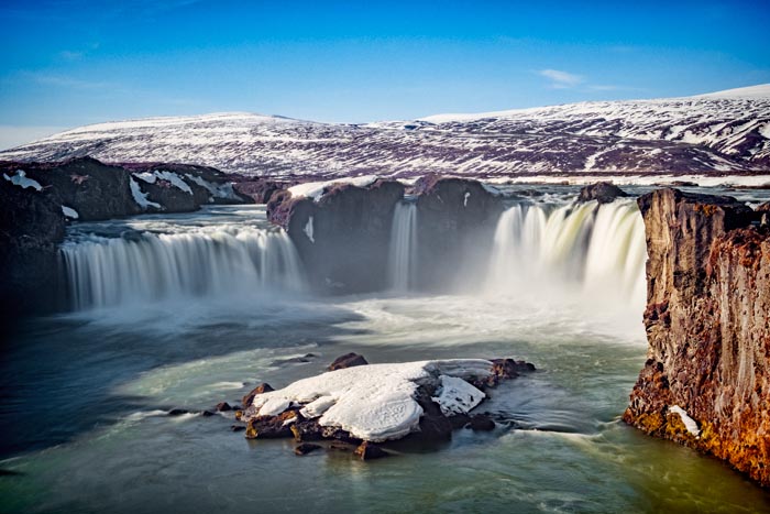
After three days in our hunting lodge, we continued west, and called in at Godafoss, where we suddenly found loads of other tourists. We needed the toilet, but the only one was in a cafe, so we had a couple of takeaway coffees, £10 or $20.
All the attractions are free at present, but that is about to end. Iceland has a population of 350,000, and 2 million tourists a year. There are hardly any toilets, and some are truly awful. They plan to start charging at the various attractions, and using the money to build toilets!
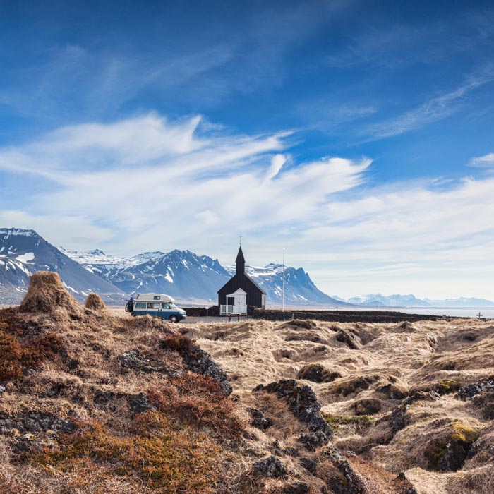
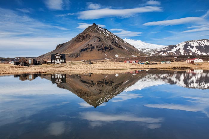
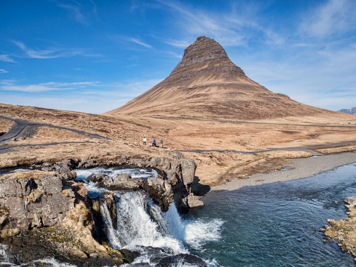
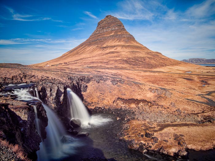
Our third cottage was the least nice of the ones we stayed in. It was OK, but a let down after the previous one. However, it was close to the Snaefellsness Peninsula, on the map to the left of Borgarnes, and a huge tourist attraction. It was the best day of the whole trip, due to wonderful weather – we actually didn’t need a coat – and lots of things to see in a small distance.
Here we see some of that lava I mentioned!
Arnarstapi, a real highlight of the day. The coast here is amazing, rock stacks, blow holes, just lovely.
We had lunch in a lovely cafe. Meat soup is a speciality of Iceland, so thought we’d give it a try:-

£35, or $70 for two bowls of soup and the bread. It was really nice, home made from scratch, including the stock and the bread.
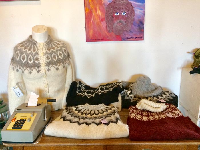
Nice hand knitted Icelandic knitwear. £150 or $300 for a cardigan. Not too bad, as these things go.
By now you may have guessed that foss means waterfall.
You can see why Iceland reminds me in some ways of New Zealand. These houses made me think of Cromwell, that view as you drive past.
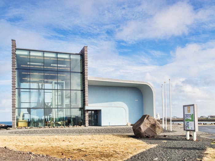
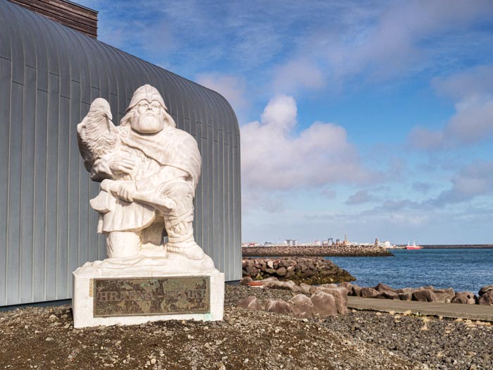
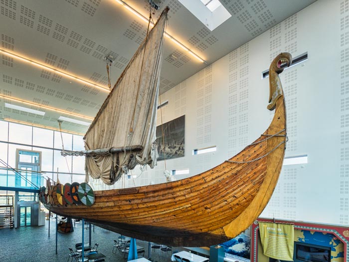
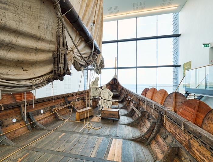
I’ve lost track of our cottages now, I can’t remember where they were or what they looked like. Anyway, here we are having a day out around Reykjavik. We didn’t bother stopping in the city. We drove straight through and stopped at the Viking Museum.
Loved going into the Viking ship. Not something either of us ever expected to do!
Next out on to the Reykjanes Peninsula, to the left of Reykjavik on the map. Stampar Crater Row extends for 13km, would have loved to spend more time walking around here, but it was hellish windy.
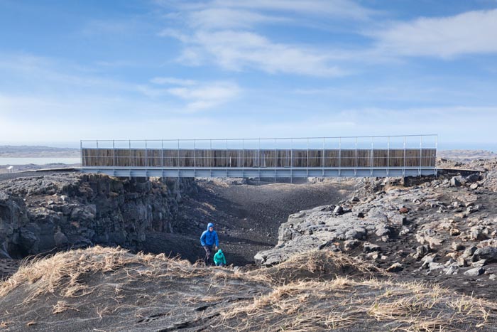
The Bridge Between Continents. Tried not to think about what would happen if there was an earthquake when we were standing in the gorge:-
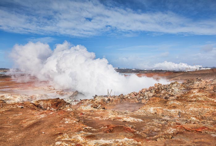
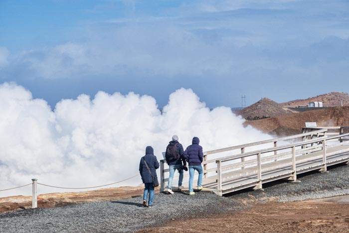
A very noisy hot spring:-
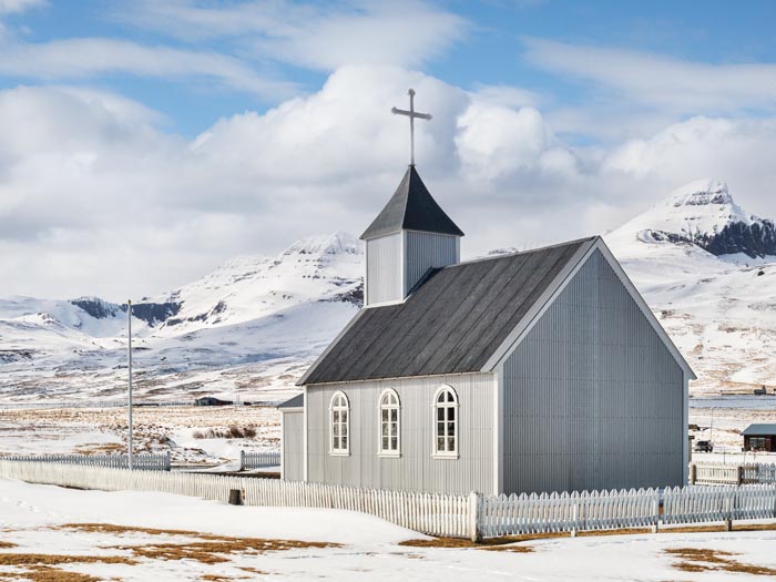
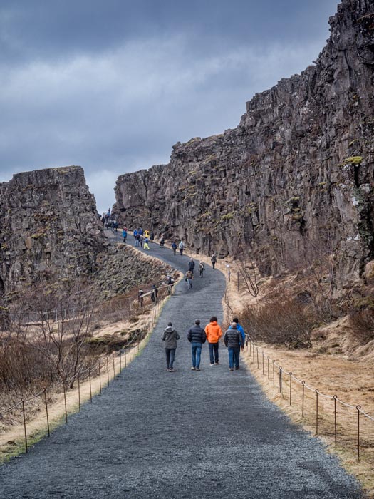
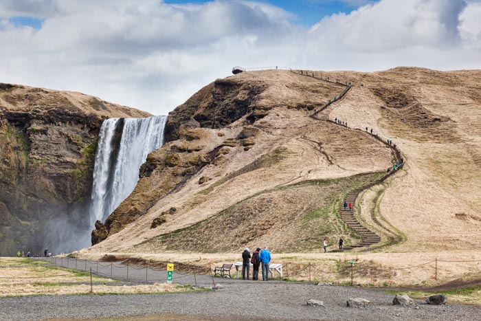
Now, onto the south coast, the part we’ve been waiting for. I’m glad we went north first, because the south is so incredible, the north would have been a disappointment, and that would have been a shame. Horrible weather here at Thingvellir, very drab. They are putting up huge new visitor centres on the south coast. It cost £1.50 or $3 each to go to the toilet, but we didn’t need to buy a coffee. This was a huge meeting place in the old days. There were markets and public executions of all varieties, you can read notice boards to tell you what was done to who, and where. People used to travel for up to three weeks to get here.
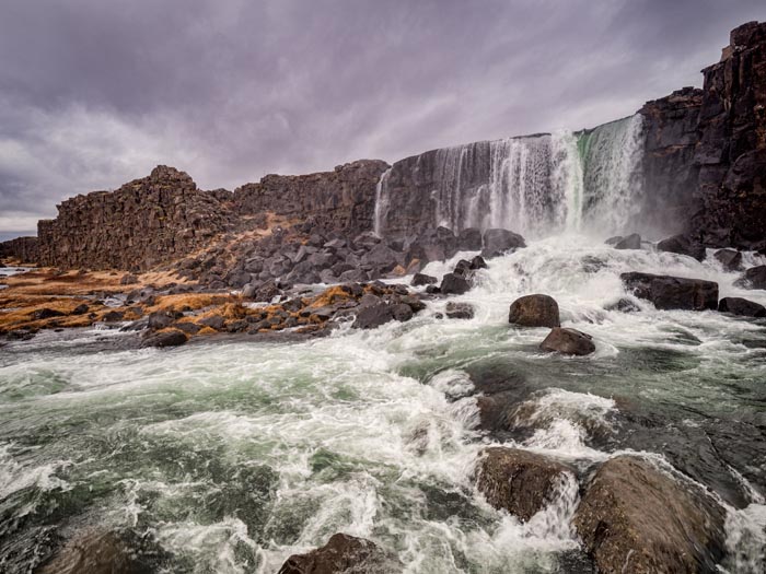
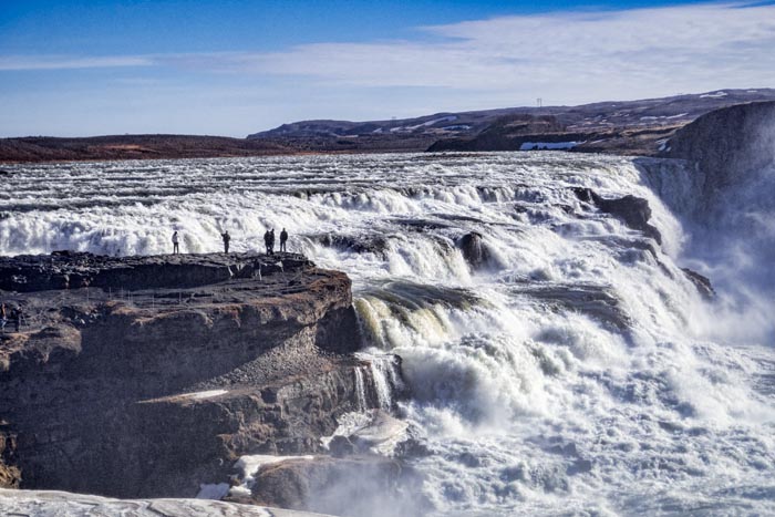
Next, the famous Gullfoss. Firstly, No Drones:-
Then, the waterfall:-
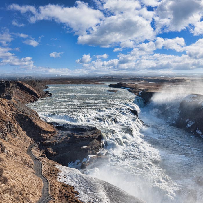
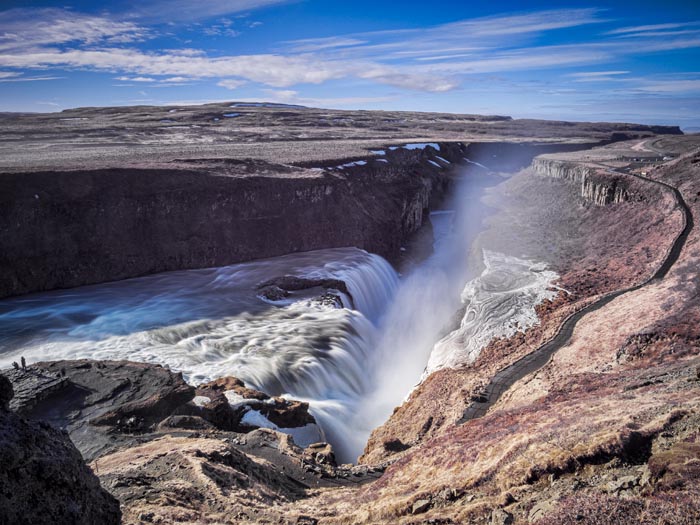
You can walk around quite a bit, lots of trails and different viewpoints:-
You can’t really photograph it in one shot, well maybe if you had a drone, so here is a different bit:-
Then, just up the road, Geysir, the original. This was the first geyser seen by westerners, and the word geyser comes from the old Norse geysir. The original Geysir is currently dormant, except when there’s an earthquake, but this one goes off every five minutes or so:-
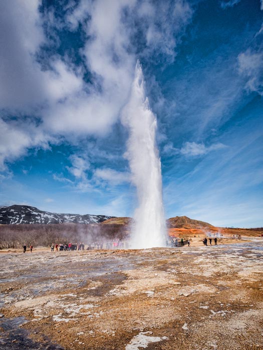
It was hard to capture, so Colin put the camera on the tripod and set the camera to 12 shots per second until he got it. They don’t have to add detergent to make it go off, unlike the one at Waiotapu.
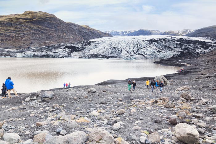
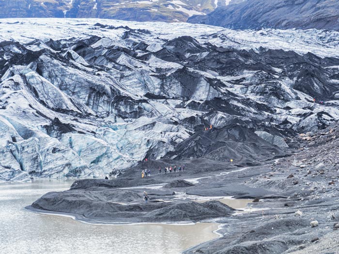
Iceland has a lot of glaciers. We stood in one spot on the south coast and could see four. We walked up to this one:-
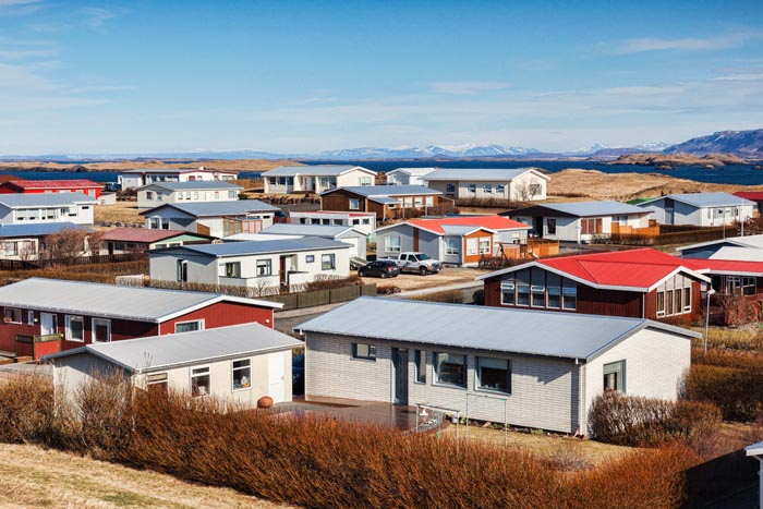
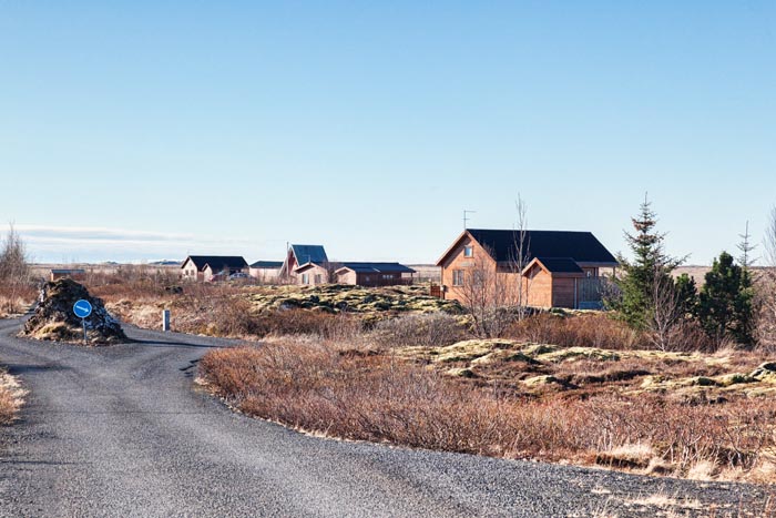
We must have moved on to another cottage somewhere here, because I took this photo of some of the summerhouses around us, as we left:-
This waterfall was within walking distance, which meant we could get up early and photograph it in good light:-
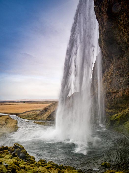
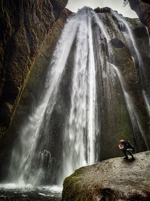
Another very famous foss, there is a cave behind it so you can walk round the back of it, which sounds exciting, but was cold and wet!
This was just a short walk from Seljalandsfoss. Colin waded into the stream to get this shot, I’d had enough of being cold and wet. I can’t help thinking Gollum!
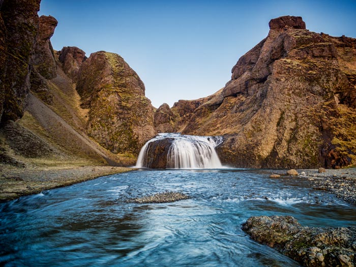
Another foss, just down the road. We didn’t climb those steps. Colin said there was no point, as the view at the top of waterfalls is never very good. Ha!
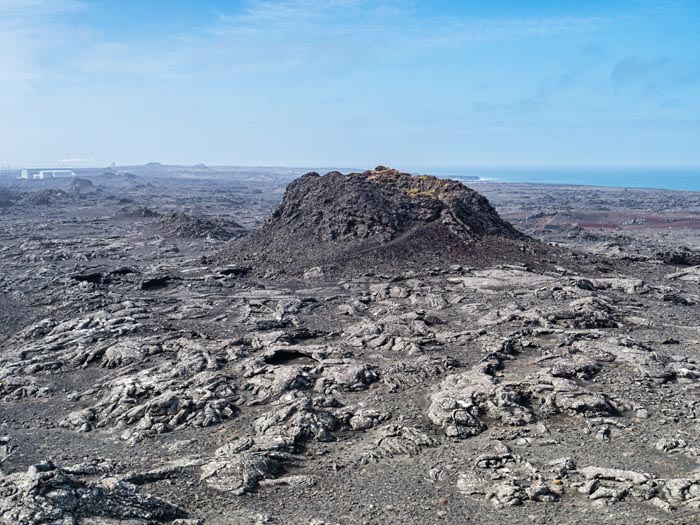
More lava. This is over 3000 years old, and has moss growing all over it:-
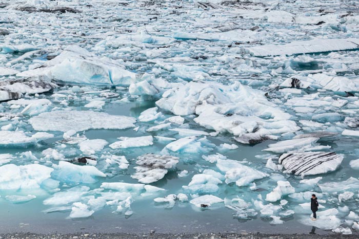
Now, Jokulsarlon Lagoon. The ice breaks off the glacier, which you can see in the background, and floats down the river :-
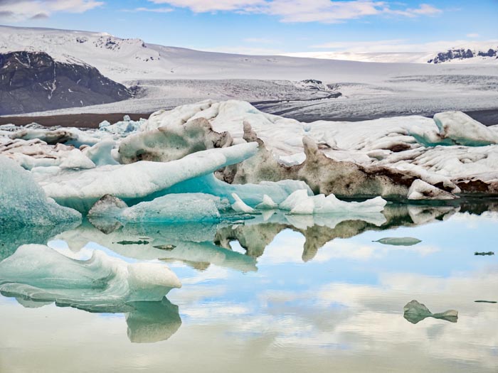
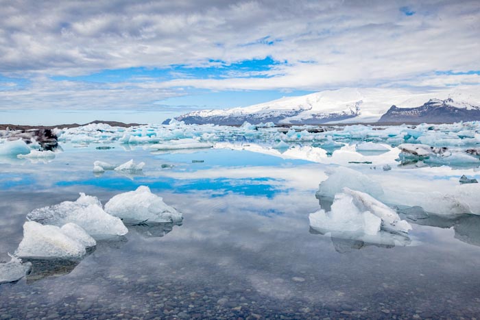
This silly boy was standing on the ice, in spite of all the signs. He fell in. I laughed. He must have heard me. Couldn’t help it!
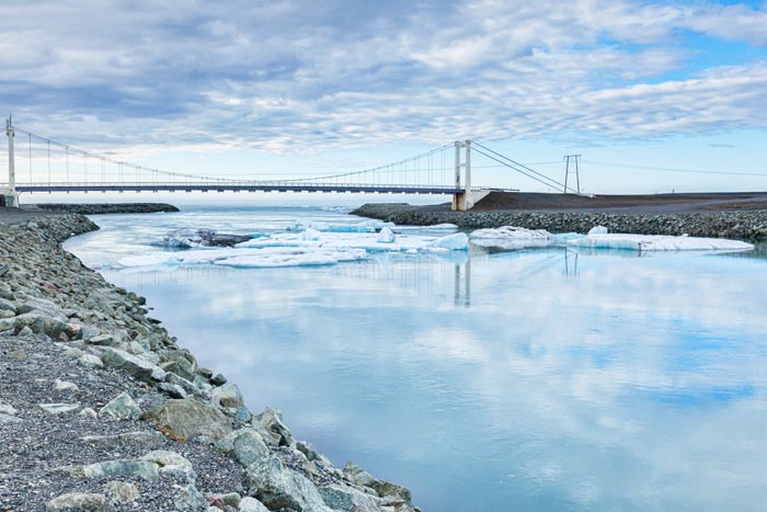
Floats down the river, under this bridge:-
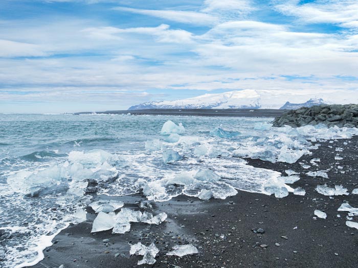
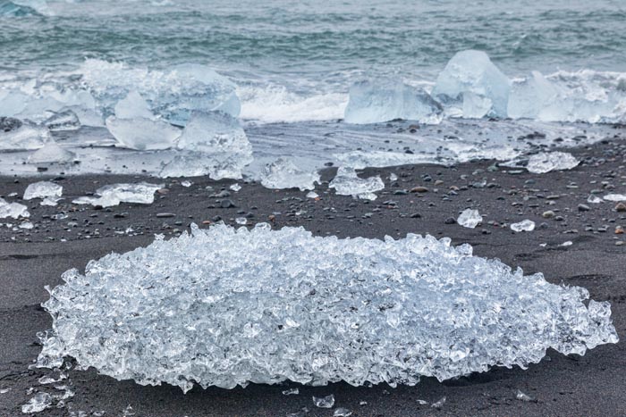
And gets washed up on this black sand beach:-
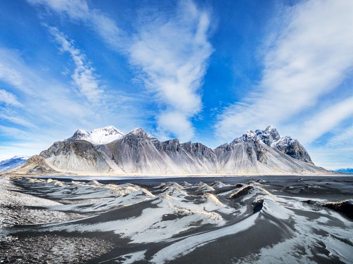
We are into our final day now, another lovely day, full of fantastic scenery:-
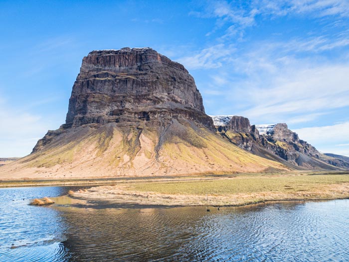
This land is privately owned, and the owner charges entry. I probably would, if I owned something like this:-
Colin decided to take a short cut, over a high mountain pass. We went from 0 to 1500 feet or 457 meters and back down again. It was a bit hairy, but once we were safely down I was glad we did it.
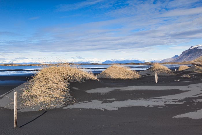
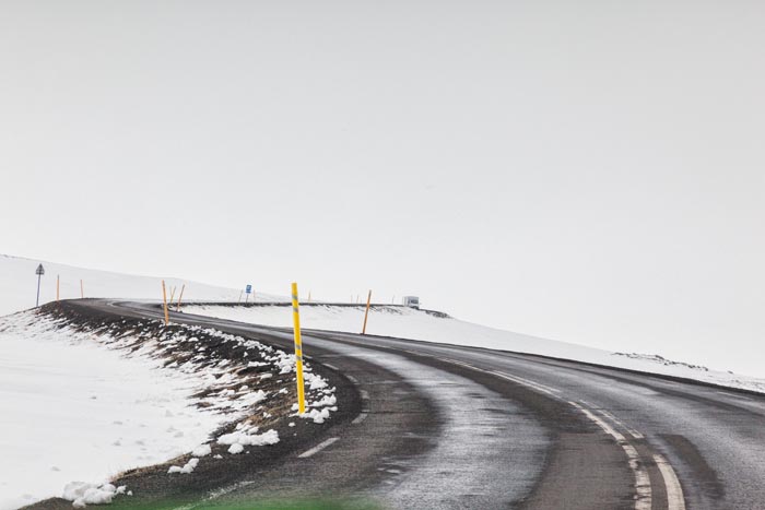
Nearly back to the ferry now, still lots of snow in east Iceland:-
And that was it, except for the return journey. We were hoping for better weather in the Faroes, but it was worse, and we didn’t get off the ship. Just a little bit of sun, just before we left:-
We would love to go back, and spend more time. Maybe take the caravan and stay for six weeks, camp nearer to the attractions so we could get better light. But at our age, with so many other things to do, who knows?
Friday we are off to Devon and Cornwall!